Thursday, July 30, 2015

BEAUSOLEIL NATIONAL PARK

Wednesday July 29

Beckwith Island, with all of its boats, was actually a nice island. The water was cool enough to be “refreshing,” but warm enough that Elaine actually went in swimming. It was also very clear. When we weighed anchor in the morning, I could clearly see it dug into the sand at over ten feet deep.

There were a couple of places east of Beausoleil Island which we had passed by on our way north a few weeks ago, so we thought we would explore a little bit. We cruised up the Musquash Channel, looking for a nice protected anchorage to wait out the 20+ knot winds forecast overnight. We went into Brown Bay, even tucked way past the big rock at the end into a cove only big enough for our boat. It was an idyllic spot, totally protected from any wind, but the water was brown - clear, but brown the color of tea. It was still early afternoon, so we got the dinghy down and went exploring around the top of Bone Island. Since we were out and around, we dinghied over to the Beausoleil National Park dock on the southern side of Bone Island and were surprised that it was almost empty. Elaine had read that there were things to do there, so we went back to the boat, weighed anchor and moved over to the park cove. It ended up that what she had read was for a different part of the park, on a different island. Oh well, we were there, so stayed anchored for the night. It was very warm, the wind that was supposed to come, didn’t, and we spent a fair amount of time in the water trying to cool off. As still as it was, we weren’t overly bothered by bugs…
IMPROV at anchor, Bone Island

Thursday July 30

The wind picked up a bit this morning, but there are so many islands, so close together, that it really isn’t bad getting around - you just have to be very aware of the forecasted wind direction when you go looking for a place to anchor for the night. With the winds at 10-15 knots, we went over to the Cedar Grove dock on Beausoleil Island. There was an empty spot on the dock, so we pulled in. This is the place Elaine had read about. There were trails, beaches, camping areas and a visitor center complete with nature talks.
Colorful frog on Beausoleil Island
We spent the day there, even getting the bikes down and biking a path which went down to the southern tip of the island. We were almost to the end when we were attacked by swarms of mosquitoes and decided to turn around. The dock was very exposed to the wind and the wakes of passing boats, so we left and went up to Chimney Bay, close to where we had anchored our first night a few weeks ago. The entertainment for the evening was watching boats coming in to the bay anchoring and those already there re-anchoring after dragging their anchors in the 20+ knot wind.


Elaine is convinced we are wind magnets. The forecast is for 20 knot winds tonight, dropping to 15 by midnight then back to 20 tomorrow night and through the weekend. May do a little more local exploring, then head back to Midland within the next few days…

Tuesday, July 28, 2015

CAPE CROKER/BECKWITH ISLAND

Monday, June 27

A pox on all credit card services! It was an extremely frustrating morning after filling our grocery cart, going through the check-out and having our credit card transaction not be authorized. Now, we are not exactly naive travelers or inexperienced when it comes to managing credit cards during international travel, so it was very upsetting to learn that our cards had been de-authorized. This was after letting the bank know when, where and for how long we would be traveling. In fact, I had phoned them within the past few weeks to update our travel location, but apparently, nobody pays any attention to that.

Elaine, getting us back to the boat on the dinghy
Allow me to back up just a couple of steps. Several weeks ago, we discovered that one of our credit cards (we carry two accounts) wouldn’t work. When I called the bank, they informed me that they had sent updated cards to our home address, and that all we had to do was use the new cards now that the previous cards had been cancelled. As idiotic a move as this was, since they knew we were on an extended travel schedule 3000 miles from home, we just decided we would not use that card anyway, and use the other account. Then the second bank did the exact same thing. When asked why they sent out new cards, even though the old ones had a year before expiration, they said it was a “service” to their customers to automatically extend the expiration date.

Bruce Peninsula
The bottom line was that the bank said they were bound by California State law to de-authorize the card and we were just SOL. So here we were, trying to pay for food and fuel in a small village in remote Ontario, Canada with a bad card. The bank’s solution was simple - “Just give us the address where you are staying, and we’ll mail you new cards within 5 business days.” Half of the islands where we anchor are uninhabited! No streets, no cottages, no postal service… And they’re going to catch up to us on the boat and hand us our new cards. Yeah, right. After over a half hour on the phone (being charged international roaming charges, even though it is supposed to be a toll-free number) I finally got through to a supervisor in the credit card fraud department. She managed to tweak something with our account and said it might work now, so try to buy something while she waited on the phone. I went to a restaurant at the end of the dock and tried to buy a cup of coffee with a credit card - their card machine was broken. I then went up to the street and started walking, trying to find some vendor who would take my card (all while the bank person was waiting on the line, and I was paying roaming charges). I found an LCBO (Liquor Control Board of Ontario - a wine shop), went in, grabbed the first bottle of wine I saw off the shelf and went to the register to use my card. It worked. The bank promised that it would continue working. Just in case, we walked to the local bank (on the highway, outside of town) and got some cash.

By this time, we figured it would have to be a short cruising day, so we took off toward Cape Croker and anchored in a nice, secluded harbor about 15 miles away.
Lighthouse on Cape Croker
River otter pups feasting on a fish carcass


Tuesday, July 28


We have two more days before the next front is forecast to pass through with 20+ knot winds. Our plane reservations for the quick visit home are 10 days away. We don’t want to be stuck too far away if the wind blows for too long, so we decided to start heading in the direction of Midland, where we will  moor the boat while we are gone.
Taking advantage of the autopilot to knit
Our initial thought was to hop down the Bruce Peninsula and spend the night in McGregor Bay, but we got there by about 11 AM, the weather was great with a light southwest wind and 1 foot waves, so we decided to make the 30 mile crossing to Beckwith Island, putting us on the east side of Georgian Bay. We are definitely back in the popular areas - there were about 35 boats anchored in the bay when we came around the point. There was plenty of room, though, so we anchored and appreciated the warm weather and the (little bit) warmer water in the southern bay…

Sunday, July 26, 2015

TOBERMORY

The wind died down a little overnight, but it was still there when we left Club Island about 7 AM. We continued on, picking up our bearing for Tobermory and passing between Flowerpot Island and Bear’s Rump Island.
One of the "flowerpot" formations on Flowerpot Island
Glad we waited until this morning - even with the slackened wind, it was not completely smooth cruising. We stuck our nose into the harbor at Flowerpot, knowing that there is a dock in there and it is a National Park where our docking permit is good for free mooring. The water is incredibly clear, and, although the depth sounder read 7 feet, it looked like we would hit rocks at any time. Elaine wasn’t comfortable going in, so we backed out and continued on to Big Tub Harbor, which is the only designated anchorage in Tobermory. Unfortunately, Big Tub Harbor is 40-50 feet deep and has a constant stream of tour and excursion boats going through it to look at the wrecks at the end of the harbor. We gave up and went over to the Municipal Docks and got a slip.

Tobermory is a cute little town with a resort feel to it. Lots of gift shops, clothing stores, restaurants, etc. We had a bit of a hassle getting electrical power at the docks, but while we were out exploring the shipwrecks in the harbor with the dinghy, they got everything squared away and we had power once we were back on board.
Shipwrecks in the harbor
It’s a very busy harbor, partly due to the season and partly due to the weekend, but there are private yachts (in the 60-70 foot range), tour boats, glass-bottom boats, ferries and even kayaks constantly streaming by our boat, which is docked at the outside end of the harbor. One of the draws here is the abundance of shipwrecks which can be seen in the clear water. Visibility is at least 50-60 feet underwater, although snorkeling is a bit of a challenge with the water being only about 60 degrees or so.

We took a walk around town, even checking out the 385 foot Chi-Cheemaun Ferry which goes over to Manitoulin Island. I talked with the tour boat operators who go out to Flowerpot Island, and they said the harbor entrance was 5 feet deep - plenty of room for my 2’4” draft. We may go out there tomorrow and check it out some more.

You can tell you’re in a decent little town when you run across a brew pub, especially one that brews a nice porter. It was pretty warm by the time we finished our walk around town so that porter tasted mighty fine.


We’ll need to do some provisioning tomorrow morning before we leave, but there’s a grocery store right at the harbor. Having minimal food on board is as good of excuse as any for dinner at a nice restaurant tonight…

Saturday, July 25, 2015

SNUG HARBOR/CLUB ISLAND

We left Spanish, heading for Gore Bay on Manitoulin Island under incredibly calm conditions, and were halfway there when the updated weather forecast was broadcast and changed our minds for us.
Calm morning, for a change
We’ve spend several days, now in the North Channel and, as pretty as it is, we decided to head back to Georgian Bay for a couple of reasons. One is that the forecasts have consistently predicted better weather in Georgian Bay and two, North Channel is quite remote and, in general, primitive. Elaine likes to see interesting towns, museums, shops, etc, and there’s more of that in Georgian Bay. So, instead of Gore Bay, we headed east through Little Current and anchored in Snug Harbor, positioning ourselves for the next weather window to head south, out of North Channel, across Georgian Bay to Tobermory.
Sung Harbor

Snug Harbor was a great place (although no cell/internet connection), being very protected and large enough for many boats. We anchored in about 30 feet of clear water. I scrubbed down the boat to get warmed up enough to dive in and clean the waterline and bottom. It took about a half hour to do the bottom, and I was pretty chilled by the time I was done.
Another great dining view in Snug Harbor


The forecast was for high winds overnight (naturally) and rain/thunderstorms in the morning, clearing by early afternoon. The winds never came, but the rain/thunderstorms appeared briefly and were gone by 10 AM. Updated weather called for 15 knot winds, decreasing by afternoon with wave height 2-3 feet, also decreasing by afternoon. We took off for Tobermory, about 45 miles away, and for the first ten miles it was tolerable, if not pleasant. Then we hit more open water and, by early afternoon, the winds picked up rather than died down. We were going into 3-4 foot waves and had to reduce our speed, which would have made it a very long slog into Tobermory.
Club Island anchorage
We had a couple of possible bail-out points, and about half way through the crossing ducked into an anchorage on Club Island - a deserted, low island with a large harbor which offered protection from the waves, although not much protection from the wind. At least the water surface is smooth, and we can wait out this front, which is supposed to pass through by midnight tonight, leaving calm conditions in the morning…

Friday, July 24, 2015

SPANISH RIVER

Thursday, July 23

The wind died down a bit overnight, so we weighed anchor to get out into the channel before the whitecaps started up again. The water at our anchorage had cleared up considerably overnight and I could see the anchor in about 20 feet of water as I was pulling it up. Too bad the water had not warmed up as well.

Our first idea was to go to Eagle Island which, on the chart, had a nice big bay on the northeast side, but scout out Gibson Bay on Fox Island on the way over. Gibson Bay actually looked pretty nice and protected, although it is deep water right up to shore, a couple of boats were already there, and it was only a few miles from our last anchorage. We kept on going to Eagle Island, where we were a bit disappointed in the exposure. The wind was already coming up and, clearly, hitting the bay fairly strong. We kept going. We had thought we might stop in at the town of Spanish in another day, so going in that direction we scouted out Shoepack Bay. It was very protected, although deep, small, and there were already boats anchored, swinging on one anchor. Because they were swinging, there was no room for anyone else to come in. We kept going. By this time, around noon, the wind had come up and there were 2-3 foot waves and whitecaps in the exposed channels. Spanish wasn’t that far away, so we headed there to spend the night in a marina.
Spanish Municipal Marina

It’s a nice marina, although not much of a town. There’s a sporting goods shop, a couple of minimal grocery stores, a liquor store and some restaurants about 1.5 miles away. The best thing about the marina is the community building right next door. It’s a modern, 2-story structure which houses classrooms, event spaces, a workout gym, laundromat and full washrooms with showers (which marina tenants can use).
Community center

After a walk into town, mainly just to stretch our legs, we were entertained by other boats trying to get in and out of their slips in the strong wind.
Ontario countryside around Spanish

It’s now Friday AM, and, looking at the weather forecast, we have a day before another strong front comes through with 20-30 knot winds. The extended forecast really doesn’t show much relief for another 3-4 days. We would like to head over to Tobermory on the Bruce Peninsula, but that entails some open water, so we may gradually position ourselves over the next couple of days, hopping from bay to bay, and take off for the crossing on the first good-weather day.
IMPROV docked at Spanish


Yesterday, we made plane reservations to head home for a week in August, so we will want to be back to Midland before we go,  to put the boat on a mooring while we are gone…

Wednesday, July 22, 2015

CROKER ISLAND

Really getting tired of this wind. We moved to the Benjamin Islands today, but spent a good amount of time looking for an anchorage. The cruise over was only a couple of hours, but, even leaving in the morning, the conditions became worse and worse. We were fighting 4-5 foot waves by the time we reached South Benjamin Island. The first place we anchored was protected from the wind, but a swell coming into the bay made it very rolly. We went around to the other side of the island and found any and all protected anchorages already taken up by boats. I felt like I was trying to find a parking place in San Francisco! We backtracked a bit to the east side of Croker Island and finally found a protected cove with only one other boat anchored. We anchored and put two stern lines to shore, tied to rocks (covered with bear scat, by the way). Even with the island and forest behind us, protecting us from the direct wind, we still get pretty of strong gusts curving around the cove.

It was afternoon by the time we got anchored, so after a quick lunch of leftovers, we tried to explore the island, but the growth was too thick. We jumped in the dinghy and explored some of the area along the shore, but we couldn’t go far without getting into more waves and wind. The forecast is for winds to diminish tonight from 20 to 10 knots, but building again tomorrow afternoon to 15. More wind on the way for Friday & Saturday before lessening on Sunday.

As I mentioned before, all of this wind is churning up the water, mixing the warm surface layer with the colder lower layers. Even a week ago, it felt good to jump into the water, but now it’s pretty brisk. I took my soap, shampoo and towel over to a small, isolated cove so I could bathe, but it was a pretty quick bath.


My internet data plan is quickly being used up, so pictures may have to wait a bit. Just imagine us in the back draft of a jet engine and you’ll get the picture…

Tuesday, July 21, 2015

AMEDROZ ISLAND

Continued Strong Wind Warnings today on the weather forecast. It looks as if it will be this way for another day or so. Winds have been steadily 15-20 knots with stronger gusts. Our anchorage last night was protected, but the wind howled through early this AM and got the boat moving enough to send it into “creaking” mode. Usually the boat doesn’t creak unless the water is rough at anchor, but the water stayed fairly calm (considering the strong wind) and the boat made noises. 

We decided to switch anchorages, thinking we might find someplace that would not only have smooth water, but give us some protection from the wind. On the chart, we saw a cove couple of islands over that looked like it would suffice, so we weighed anchor and headed over there. Surprisingly, the channel exposed to the wind wasn’t too bad this morning, so the couple of hours we were underway were tolerable. On our way to the cove we had selected, we passed by another island, and looking with the binoculars, saw a small, un-named cove with water like glass, when all around it there were whitecaps. We headed in and anchored in an incredibly still cove with water so clear, we could see the bottom at over 15 feet deep.
Our well-protected anchorage on Amedroz Island
Once we were settled, we took the dinghy over to shore, hiked around a bit, and I found some nice, ripe wild blueberries (always alert for bears).

We were in the cove by ourselves until mid-afternoon when three sailboats came in and anchored as well.

Our inverter/charger (the device which both charges the battery when hooked up to shore power and changes DC power to AC) has been giving a warning message that the internal temperature is too hot when it has been charging the battery. I took a look at it, and the cooling grills and circuit boards (that I could see) were covered with lint. We tried to vacuum it out, but couldn’t really get access to it and I figured the best way to clean it out would be to use compressed air. Unfortunately, I do not have an air compressor on board, but I do have a hand pump to inflate the dinghy. I rigged up a connection from the pump to a length of hose, inserted a small plastic nozzle into the hose and one of us pumped and the other directed the nozzle into the ventilation ducts. It was pretty amazing how clean everything got with just that amount of “compressed” air. Now, of course, we’ll have to wait until we are at a marina again, hooked up to shore power, to see if it did any good.

Later in the afternoon I decided to try fishing in the next cove over. It had some grass and bushes growing along the shore, which looked like good bass habitat. About an hour or so was enough to get a couple of nice-sized largemouth bass (3-4 lbs each) which we later ate for dinner. They were incredibly fresh-tasting, having been swimming around in the lake just a couple of hours before being eaten.
A little warmer, a little less wind, and it would be perfect!


We are planning on getting to the Benjamin Islands within the next day or so, depending on when this wind lets up. The cold front associated with this wind is keeping the temperature down to the low 70s during the day, and the wind is causing a lot of water mixing which lowers the temperature. My “bath” off the back of the boat this afternoon was quite refreshing (too cold for Elaine - she takes a nice warm shower on board). I could go for some warmer weather and warmer water…

Monday, July 20, 2015

BAIE FINE / BRADFORD ISLAND

Sunday, July 19

After a quick walk around town checking out some of the historic sites of Killarney, we headed out to the North Channel. We had been in communication with John & Kathe who are cruising the area in PDQ FREEDOM and decided we would anchor out together tonight in Baie Fine (where, by the way, there is no cell coverage at all). The wind was blowing quite strongly out of the southwest, pushing up 3-4 foot waves in places, so we had to pick our route trying to stay in the lee of as many islands as possible and keep the waves coming in front, rather than on the side (an uncomfortable beam sea). Bay Fine is about a mile wide and about ten miles long. There were several good anchorages along the way, but they were already taken by other boats. We finally found a nice little protected area near the end of the bay, and I anchored stern to land so we could tie the stern to a tree & not swing.
Topaz Lake
The four of us took the dinghies up to the end of the bay and found the trail going to Topaz Lake & had a nice land-based diversion wandering through the forest (and swatting away mosquitoes).
John & Kathe on our hike (climb)

After our hike, and back at the boat, I pulled out my fishing rod to pass a little time. I hooked a beautiful wide-mouth bass that was probably 4-5 pounds. While I was fighting him, I called for Elaine to get a few things ready to see if I could land him. Unfortunately, I don’t have a net, so I brought him to the back of the boat, got down on to the swim step and tried to grab his lower jaw, the way I used to when I was a deckhand on a sport fishing boat in California. I found out that freshwater bass don’t have teeth, like sea bass, so his jaw was smooth and slippery, and he slipped out of my grasp, just as he flipped out the hook. Boy, was I bummed. I could already taste him barbecued for dinner!

We had to barbecue chicken, instead, which John did for us over on their boat. We had a great dinner with them, and didn’t get back to our boat until late, after trying to finish off their store of wine…

Monday, July 20

The wind is still up, and is forecast to be 15-20 knots for the next couple of days. We left Baie Fine, continuing west through the North Channel, with a bumpy ride into Little Current on Manitoulin Island (the largest fresh-water island in the world). There is a swing bridge just east of Little Current which opens hourly for 15 minutes. We managed to get there just in time and went right through. Little Current is a nice town, with supermarkets, banks, stores, restaurants & gift shops. They also have a very nice town dock which you can tie up to for free during the day. There is an overnight charge, but they are great docks, right in the middle of town.

We stopped and toured the town, picked up a few things at the supermarket and filled the diesel tanks on IMPROV, even though we were only about half empty. Leaving town, with a very strong westerly wind, we, again, chose our route to be in the lee of the islands, and cruised around to Bradford Island and the sheltered harbor on the east side. Winds are forecast 20+ knots tonight and tomorrow from the Northwest, and this anchorage should give good protection. 

When I turned on the power for the instruments as we were leaving Little Current, the DC breaker for our radar and chart plotter broke. Right now, this isn’t a big deal, since we don’t anticipate much fog for the rest of the trip, and we actually use my iPad for our navigation, along with paper charts, but it would be nice to have it working. After we anchored, I took a look at the possibility of swapping out a different breaker (one that we don’t use much, such as the interior courtesy lights) of the same amperage. To figure out how to take out the breakers, I turned off all of the power, then started unscrewing things. The more I took apart, the more  complicated it became trying to switch the breakers. I finally called James (anyone with a PDQ knows James) to see if there was something I was missing. Unfortunately, it is just a difficult job to take out those breakers. However, James came up with a brilliant idea. Rather than switch the breakers, just switch the wires behind the panel to a working breaker. I put everything I had taken apart back together (about an hour to take it apart & put it back) and, in about two minutes, switched the wires to a working breaker. If you can’t bring the mountain to Mohammed, bring Mohammed to the mountain!


I just have to remember to turn on my courtesy lights when I want to use my radar…

Saturday, July 18, 2015

KILLARNEY, NORTH CHANNEL

Sunset at Bustard Islands
A grey, rainy day at the Bad River anchorage
Woke up to a sky as grey as yesterday, but after a cup of coffee, things started to lighten up a bit. It had stopped raining, so I got out on deck and scrubbed/washed most of the insect remnants off the boat and organized the stern anchor a bit so it would be easier to deploy. The bay we are anchored in is the run-off for the Devil’s Door Rapids which drains a considerable amount of the watershed around here into Lake Huron.
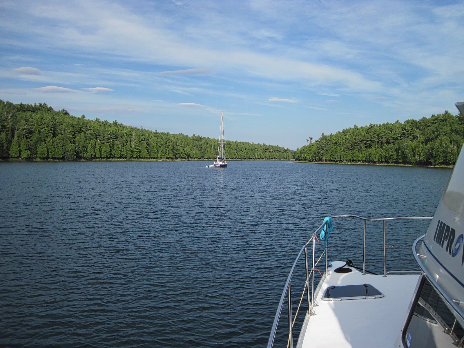
The river above Devil's Door Rapids
Since I had seen photos of other people do it, I revved up the dinghy and we went upstream through the rapids into some beautiful rivershed areas. It really wasn’t that much of a rapid, and was pretty easy to run, but it gave us a diversion for the morning. We then took the dinghy (at high speed) out to the mouth of the Bad River, about a mile away, to see just how bad it was. It looked OK, with no whitecaps in sight, so we decided to get back to the boat and head up to Beaverstone Bay - the 14 mile “outside” jaunt. As we got back to the boat, another boat had just come in and was anchoring next to us. Elaine asked if it was rough outside, and they replied “not at all,” so we took off.

It wasn’t bad, only about a 1 foot sea and we even thought about bypassing the small boat route and heading direct to Killarney, but decided we wanted to slow down and see the scenery, so went into Beaverstone Bay and through Collins Channel - both very pretty.
Granite walls in Collins Channel

We did have some electrical issues along the way, although we traced them down to a slightly discharged house battery bank. Since we had been anchoring out for a few days and it had not been sunny, our solar panel just couldn’t keep up with our usual electrical demand. Normally, one would run their generator for an hour or two every day to charge up the batteries, but, for the past couple of years, we have relied on the solar panel in sunny Florida. This far north, especially with the rain and clouds, the solar panel is just not as efficient. We’ll have to monitor that situation a bit closer than we have in the past.
A narrow part of the channel

We continued on to Killarney, the “entryway” to the North Channel - one of the most popular and beautiful cruising grounds in the world. We decided to stay at a marina for the night so we could wander around town and pick up a few things we needed and plug in to electrical power to make sure the house bank of batteries was fully charged. The infamous Herbert’s Fish & Chips is here in Killarney. It used to be a fish & chips take-out stand in a converted school bus, and everyone stopped by as they passed through Killarney. Although still a take-out place, they now have their own building where the bus used to be parked. We stopped by for a take-out dinner, went back to the boat, opened a bottle of pinot noir and ate on the flybridge as the sun came out for the first time in about three days.


It looks like I have reasonable internet connectivity, so I’ll try to include a few pictures from the last couple of days…
Even with all the clouds last night, a nice sunset
Notes from Elaine

So our boat's name is IMPROV and our hailing port is San Francisco (okay, we are from Corte Madera, but close enough, plus we stamped our hailing port as "San Francisco" on our boat before we bought our house in Corte Madera and everyone knows where San Francisco is located). What happens is everyone assumes (me included, until a few years ago) that we came from San Francisco (I guess through the Panama Canal) so I have to explain that we started the trip in Florida (still, a long ways away) and we kept the boat on the Atlantic coast and have traveled here from Florida. In fact, you can stamp ANY location on your boat as your hailing port, including Denver, Colorado or Winnemucca, Nevada or Timbuktu. My ignorance of the boating world increases. 

However, having said that, my husband has been boating since before I met him (me, not so much). We have owned a boat most of our married lives, but never really embarked on such major expeditions as the last few years. My friends and family say they could never live on a boat for months at a time but I beg to differ. I KNOW my friends and family, and they COULD do what I am doing - because I am a BOAT WIMP! Plus our boat now (albeit, tiny) has all the comforts of home - AC, heating, microwave/oven, stove, refrig/freezer, full head with shower and two "staterooms" (which are the size of a queen size mattress).

Dave is an excellent captain and boat handler, but we share navigation duties throughout the trip. I prefer to handle the boat in rough seas so I don't get seasick.  I prefer to navigate. Since Dave docks and undocks the boat the ultra majority of the time (I only have the confidence to do it during the calmest waters) I have become proficient in line handling. My confidence has soared during this trip.

So I head into the North Channel, Canada, brimming with confidence, until I display my lack of knowledge once again. There is a Michigan island stuck in between all these Canadian islands? Are you kidding me? Who drew up these international boundaries anyway?

Friday, July 17, 2015

BAD RIVER

NOTE: We have a very weak internet connection out here in the middle of nowhere. To get the full effect, read this VERY SLOWLY...    (pictures to follow)

Well, the wind finally did come up last night, and it was fairly strong. However, we were well protected in our little cove, the only issue being that the wind, coming from the south, swirled around the cove and hit us broadside from the southeast and we had anchored bow & stern facing south. It actually wasn’t bad, since the cove was so well protected that wind blowing over the trees at 20-25 knots only swirled around at about 5 knots, so we had no issues with the anchors holding. Nevertheless, I was up a couple of times during the night to check on things.

The wind had calmed a bit by this morning, and the forecast was for continued calming throughout the day, although rain in the afternoon. The next leg of our cruise required that we go into unprotected, offshore water for a minimum of about 14 miles, and we were concerned that the water might still be rough from last night’s wind. We decided we’d give it a go, but had a couple of contingency plans, and a bail-out point if things are too rough. The first mile or so from the anchorage was OK, but we were still in the lee of the Bustard Islands. When we were about 2-3 miles out, things started getting rough quickly. Within a half mile, the waves went from 1-2 feet to 4-5 feet as we reached the open water. The first contingency plan was to turn around & go back to the same anchorage as last night, the second was to head up Bad River to a protected anchorage there. By the time things got rough and we decided not to keep going, we were several miles from last night’s anchorage but only about a half mile to the channel for Bad River, so we chose Bad River. The cruising guidebook said not to attempt entering the channel in rough weather, but the visibility was good - I could see the range markers and the channel markers clearly - and the seas were behind us, so we threaded our way between the waves crashing on the rocks, into the channel and calm water. The anchorage is about a mile up the river, and we expected to find it packed with cruisers, but there were only three other boats there, and plenty of room to put down a bow anchor and swing to the wind.

By the time we anchored and got the boat secured, we were pretty cold. Even though it was probably in the mid 60s, it was raining and the wind, instead of letting up, had gotten stronger. A quick warm shower and a bowl of hot chili for lunch helped get us, and the boat warmed up. It was an incredibly grey day, all day long, with a light, but steady rain and some thick fog in the evening. This really is a beautiful anchorage, and I could see how it would be phenomenal if the sun were shining. But, it was an “inside” day today, studying, reading mystery novels and (Elaine) knitting.


We’ll check out the forecast first thing in the morning, and if it looks like there’s any chance of reasonable water we’ll keep on going up to Beaverstone Bay, then have a protected inside route almost all the way to Killarney and the North Channel…

Thursday, July 16, 2015

BUSTARD ISLANDS

We were discussing today’s options over coffee, and remarking on how flat the water was, when we decided we had better take advantage of the situation and get moving, since the forecast included high wind warnings. It was supposed to be windy last night, as well, but it wasn't too bad. Whenever we anchor out, especially if the wind is expected to change in intensity or direction during the night, I usually get up at least once in the middle of the night to take a walk around the deck and make sure all is well. When I woke up last night, it was pitch black. I could not even see my hand in front of my face and absolutely no light was coming in through the hatches. I got up on deck, and, as dark as it was, the night sky was incredibly illuminated with thousands and thousands of stars. Several of the constellations jumped out at me, and the Milky Way looked like a ribbon running across the sky. The wind had changed direction, but the anchor was holding well, so I went back to bed.
Pointe au Baril

After trying to clean off some of the hundreds of mayflies which took up residence on the boat overnight, we took off from Franklin Island and jumped offshore at the first chance, in order to put some miles under our belts. We left the Small Boat Route at Pointe au Baril (Barrel Point) and came back in about 14 miles later at Byng Inlet.
A bear, swimming between islands
The inside route then became very tortuous, with many tight turns and channels. It was pretty, but if we had stayed offshore, we would have been much further toward the North Channel in the same time.
Some narrow channels, and lots of rock


The forecast was for 10 knot winds from the south all day (fairly accurate) then increasing to 15 knots, SE by late afternoon (the wind died down) then 20 knots from the south by midnight (it’s 9 PM and the water is like glass). Who knows? It may pick up later. If it does, we’re prepared. We stopped a bit early because we were near a protected bay. We came in and anchored in a small cove, facing south with our bow to the rocks, and put out a second (stern) anchor so we wouldn’t swing, since the cove does have some fairly shallow rocks nearby. 
Our protected cove for the night.

Wednesday, July 15, 2015

REGATTA BAY, FRANKLIN ISLAND

Tuesday, July 14

We woke up early, trying to chase down the mosquitoes that found their way into our stateroom. By the time 2 out of the 3 were dead, we were awake anyway, so were up at about 5:30. The third one got lucky and lived to bite another day. The weather stayed quite pleasant, no high wind as was forecast, and we left Echo Bay to wander through the islands, via the South Channel, up to Parry Sound. Parry Sound is both a large bay and a large town, so we went to Parry Bay, the town. It was a very pretty cruise, although it only took a couple of hours. We went even slower than our regular cruise speed because we knew we would get to the Parry Island Swing Bridge early, and it only opens once per hour, on the hour. We got there early and I called the bridge tender on the VHF radio, just to let him know we were wanting to go through when it opened, and he informed me, gruffly, that I’d have to wait another 15 minutes until 11 AM (which I knew anyway). After getting through the bridge, we tied up on the Town Pier in Parry Sound (the town) and were able to get power and water for the night at the same charge as being at the marina, but it was closer to town. 

We got the bikes down and took off for the major shopping center. We didn’t need all that much, but Elaine found out that there’s a Starbucks there and she had a coupon, which expired today, for a free anything coffee. Well, the Starbucks was just a drive through in a gas station that was incredibly difficult to get to anyway, so we gave up on that. We did stop by a store to buy a mosquito killer recommended to us. We’ll be ready if that third guy ever shows up again!

We stopped by a farmer’s market for a few things and wandered around the downtown area a bit before getting back to the boat. Although Elaine had some steaks defrosting, we decided to take advantage of being at a dock and near restaurants and go out for dinner. We went to the Bistro by the Bay and had one of the best meals of the trip so far.
"Hole in the Wall" channel in Parry Sound (the bay)

Wednesday, July 15


Elaine took a hike. There’s an old fire lookout on a hill overlooking town, and a museum nearby, so she decided to visit them. I stayed at the boat, getting some maintenance done and getting ready to depart when she returned. A very strong north wind had come up last night, and was still blowing this morning, but most of our planned route today was in protected areas, so we left the dock around 1:30 in the afternoon.
Lighthouse at entrance to Snug Harbor
A couple of spots had us exposed to Lake Huron and were a bit bumpy, but it was only for a short distance. We had searched out some likely anchorages on the charts, but when we got to the one we had decided on, it had a lot of boats in it. Instead, we found a slightly less protected area nearby and dropped our anchor. I have a great deal of confidence in this anchor (a 20 kg Rocna) and although it is windy, the water is still, we have plenty of room to swing on anchor (the wind is supposed to shift 180 degrees tonight) and the scenery is better without so many other boats.
Our anchorage in Regatta Bay
I positioned the barbecue in the most sheltered place I could on the boat, and we’ll cook up those steaks that were defrosted last night. No need to worry about having to make do for dinner. On the menu: fresh pea and feta salad with walnuts and a drizzle of balsamic vinegar, the bacon-wrapped filet medallions, mashed potatoes with garlic and a bottle of Beaulieu Vineyards Cabernet Sauvignon. It’s a tough life…
Our Bistro setting, with a view...

Monday, July 13, 2015

ECHO BAY

Left our crowded anchorage late morning and headed north, knowing that the weather forecast was quite vague. We had first heard to expect thunderstorms , 30% chance of rain and high winds by Monday evening, so I identified several anchorages along the way where we could bail out if things got too rough. We cruised on glassy water most of the day, with not a cloud in the sky. We decided to head for the San Souci area,as we had been told about the infamous “Henry’s” restaurant and thought we’d give it a try.
Hitch hiker statue along the way.

We stayed on the Small Boat Route - a buoyed channel winding it’s way through the many islands - most of the time, with only one deviation to go through Indian Rock Channel with it’s pink granite islands. I have to say that I have never seen such poor boating etiquette anywhere as I have around here the past few days. Technically, one is responsible for any damage that your wake could do, but in reality, that is difficult, if not impossible, to monitor and enforce. The majority of boats we have seen in these waters are local “go fast” boats in the 25 - 40 foot range, owned, I assume, by people within a 100 or so miles who want to get to where they are going, then get back home quickly. Their attitude appears to be that if you can’t handle their wake (sometimes 2-3 feet high), then you shouldn’t be out here boating. Courtesy says you slow down as you pass another boat, so your wake will not be too uncomfortable. Not here! I’ve had fast boats pass me going probably 30 knots, and not more than10 or 15 yards away in a channel which is only 50 yards wide! It leaves me with no evasive maneuvers possible, and I often cannot turn into the wake because their buddies are following right behind. In general, these are not the “cruiser” boats that travel at a sedate 6-8 knots and wave as you go by - these are a different breed that seem to want to impress with horsepower, speed and noise. The only consolation I have is that as they go by, I’m thinking “there goes an engine that is sucking up 60 - 100 gallons an hour versus my 1.5 gallons per hour.”

Anyway, we survived the wakes and made it up to Henry’s. We looked around close by for an anchorage, even did a little gunkholing in marginally charted waters, but couldn’t find anything closer than Echo Bay, about 1.7 miles away.
Elaine catching up with the world while in Echo Bay
We anchored there, a very nice, very protected bay with only three or four boats anchored, then watched another 5 or 6 come in. It’s a fairly large bay, so there is room for them all. The water was nice and clear and I used it to scrub down the boat, getting most of the insect remains off, then jumped in to cool myself off.
Relaxing on a floating cushion.
Because we would have to dinghy over to the restaurant, we decided to have an early dinner so we could be sure to be back before dark, and just in case any of the thunderstorms showed up. The restaurant has, apparently, been widely written up, but we decided it was mostly due to it’s unique location, although the food wasn’t bad. We got back to the boat before 6 PM, and it was so warm, another swim was called for.


The latest forecast is for high winds tomorrow (I’ve heard that before) and 30% chance of rain (sounds familiar), so we probably won’t spend a lot of time on the water. We’re not far from Perry Sound, a fairly large outpost of civilization, and might stop in there to see the sights…

FRYING PAN BAY

The objective of the day was two-fold; get to an anchorage which would 1) be protected from the forecasted high winds coming from the south and 2) be convenient to the hiking trails on Beausoleil Island. We left Chimney Bay late morning, heading to Frying Pan Bay, thinking that the weekend boaters would have to be leaving around mid-day and there might be a space on the public dock. Frying Pan Bay (shaped like…, well that’s obvious) has two public docks which can hold about 5 boats each and there is room (according to the cruising guide) for about 10 boats to anchor. We went through Big Dog Channel (which, I’m sure is meant for a big dog, not a big boat - parts of it were very narrow), past Honey Harbor over to the west side of Beausoleil Island. We got to Frying Pan Bay and found at least 6 boats at each dock and 18 boats at anchor in the bay. Nevertheless, we found a little spot off to the side and anchored so Elaine could hike the island. We put out a bow anchor and tied the stern off to a tree on land so we would stay in our own space and not swing.
Path through the forest

We dinghied in to shore and took a hike around Fairy Lake. The trail was a mix of dense forest and exposed granite. The forest part had wooden walkways that mostly kept you away from the carpet of poison ivy on the ground. The only thing missing was handholds you could grab when the mosquitoes ganged up and tried to carry you away. After a few hundred yards on the trail, we went back to the boat and sprayed down with insect repellent before starting off again. We were pretty warm after our hike so we jumped off the back of the boat (yes, even Elaine!) to cool down. Nice and refreshing, as well as not using up our meager supply of water taking showers (the lake is clean, clear, fresh water).
Fairy Lake

In some of my “down time” I have been doing a bit of fishing off of the boat. There’s supposed to be plenty of good-eating fish in this lake, although, so far, all I have caught is a northern pike - about a 5 pound fish with big teeth, lots of bones and poor flavor. Normally one would just throw these fish back in the water after dislodging the lure, but I wasn’t too thrilled about working around those teeth. Luckily, the fish threw the lure as I had him next to the boat, trying to figure out what to do. It reminded me of catching barracuda in the Bahamas and getting them off the line.


Since, by this evening, the forecast has changed, and no high winds are expected, we’ll probably move on tomorrow - not sure to where…

Saturday, July 11, 2015

BEAUSOLEIL ISLAND

Friday, July 10

Finished off the Trent-Severn Waterway this morning by going through Lock #45 at Port Severn. There have been a total of 76 locks since we left Florida on this trip! Now we can put away the fenderboards and the gloves and cruise all at the same water height while here in Lake Huron.

From Port Severn over to Hogg Bay was only an hour or so to get to James & Jackie Power’s house and tie up at their dock out front.
Docked at James & Jackie's place
They had just returned from their canal boat trip in France and it was great to see them again, see their house & meet the rest of the family living there. It is a beautiful setting and very comfortable house. We jumped in the car with Jackie to get a tour of the Midland area, pick up a few things for dinner and stop by the Bell store to, with Jackie’s assistance, get a wireless data plan. Even though our US-based phones offer text and data service over Canadian networks, it is interminably slow and frustrating. I had brought an old, unlocked iPhone along, so we got a new SIM chip and now have 2GB of data per month! I guess I’ll have to start taking more pictures, now that there is no excuse for not loading them on to the blog.

Dinner was also a lot of fun with John and Kathe Macdonald joining us from Toronto. Their Boat, PDQ FREEDOM, is berthed in Midland and they are taking off for a couple of weeks to cruise the North Channel. We went over charts of both Georgian Bay and the North Channel and got some interesting bits of information about the area.

Saturday, July 11

We debated about taking off today or staying another day to enjoy the hospitality of our hosts. We borrowed a car so that we could get buy a cruising guide of the area and do some provisioning. We finished what we needed to do by early afternoon, so we decided to go over to the marina to get fuel then head up to Beausoleil Island. Getting fuel is a bit different here compared to the US. The fuel dock was staffed by a full crew of young people in the marina uniform who provide full service. Apparently by law, only a fueling crew can be aboard the boat at the time of fueling, so we stepped off, stood in the shade and watched them work. They fueled up both forward and aft tanks, pumped out our holding tank and filled up our water tank before we could get back on the boat. In the US, we were handed the diesel nozzle at the fuel dock and it was up to us to get everything done. Having fueled up many times on our own, we had a routine down where I would fill the tanks and Elaine would watch the fuel gauges, relaying their information to me so that the tanks would not overflow and make a mess on the deck. We did eliminate any overflow by doing this, but we also ended up not filling the tanks all the way up, stopping when the gauges were reading about 7/8 full. Well, we now have FULL tanks. Considering we last filled up in Bremerton, New York on June 25th - 16 days ago - we did pretty well. I’ll have to calculate our distance travelled, but a rough estimate gives us 4-5 miles/gallon over that time. Not bad for moving your house along the water.

One of the reasons we had considered waiting another day to get started was that it’s Saturday, and the weather is nice. Everyone said there would be hundreds of boats on the water today and it would likely be very crowded in the anchorages.  Well, I can assure you that prediction was not accurate. There are not hundreds of boats out here - there are thousands of boats out here today. And a surprising number of them throwing inconsiderate wakes around through narrow channels and in the anchoring areas. We’ll have to put up with this for at least half of tomorrow before they all start heading back home and leave us in peace for another week. Hopefully by next weekend we will be out of range of the overnighters in their “go-fast” boats.
Our dinner view tonight

One of the advantages of our boat is the shallow draft - we can go places where many other boats would hit bottom. Using this to our advantage today, we found a quiet place to anchor in a few feet of water between two small islands in Chimney Bay. It’s a nice, protected area with good holding for the anchor and a dynamite view while eating dinner (again). I did take a swim after we got settled in. It’s still a bit chilly when you first get in, but OK, once you get moving around It’s so nice to be able to swim off the boat in fresh water!
Tonight's sunset

Thursday, July 9, 2015

PORT SEVERN

An interesting day, today. We went through two of the most unique locks in the world.

The day started in Orellia when we left the marina around 8 AM and retraced our steps from yesterday toward lock #42 which had been closed due to a power failure. It, and the railroad swing bridge, were open today. In fact, they said they had opened yesterday by 2 PM. We had turned around about 1 PM, so could have gone through if we had been patient enough to wait an hour. Unfortunately, even they did not know when the power would be restored and had been told it could have been as late as 6 PM. That’s OK, we had a nice third night in Orellia.

Weather was quite nice with mostly sunny skies, minimal wind and a very nice temperature. We wound our way through rivers, lakes and canals until we got to Lock # 43, one of the deepest conventional locks in the world. It lowered us about 45 feet.
Elaine, looking up where we just came from
The next lock, #44, also known as “The Big Chute” is actually a rail system with a flatbed car dropping down into the water in one lake, loading on the boats, then going by rail up and over a dividing berm to another lake.
The Big Chute just after loading

They can only take 2 or 3 boats at a time (depending on the size of the boats), so we did have to wait a bit to catch our ride over. The lock attendants really like the PDQ catamarans since we basically sit flat on our bottom, so they don’t have to use the cradles and slings to stabilize us for the ride. They have learned, however, to keep the back 4-6 feet of the PDQs hanging off the back side of the flatbed so no damage will occur to the area around the props.
Traveling down on the rail car

Several times today we went through “Narrows,” areas of a half-mile or so where the water is quite constrained by the narrow channel and the current flow was very strong. On a couple of these I had to announce on the VHF radio that I was entering the channel downbound (with the current) and hope anyone close to entering upbound would wait until I had passed. The downbound vessel has the right-of-way over the upbound vessel, since it is more difficult to maneuver while going with the current.

We had thought we would actually make it all the way to Georgian Bay today, but we stopped just a bit short for a few reasons; 1) we were getting a bit tired 2) the weather had worsened a bit and the winds on Georgian Bay were strong enough to kick up a decent chop and 3) we had a nice place to stop and tie up at Lock #45 and weren’t sure where else we could comfortably stop for the night if we didn’t make it all the way.


So, tomorrow morning we will go through the last of the 45 locks on the Trent-Severn Waterway which we started 11 days ago in Trenton…

Wednesday, July 8, 2015

ORILLIA, REDUX

Tuesday, July 7

The forecast for the day is pretty stormy, so we decided to stay another day in Orillia. We had a few things to do and/or buy, and we could do that here. Besides, we’ve had enough of locking through in the rain. I spent the morning, before the rain came, on my bike, riding off to the marine supply store and a bike shop. I have been so frustrated trying to adjust the bearings in one of my pedals, that I was ready for professional help. The bike mechanic looked at my pedal and said there was nothing else he could do, so I bought a set of cheap pedals ($5) as replacement. Elaine stuck around and did stuff on the boat.

The rain started late morning and was to last the rest of the day, so I decided the conditions were right to do a major wash-down of the boat. Whenever I wash the boat I get soaking wet anyway, so doing it in the rain doesn’t really make much of a difference. It’s pretty amazing how dirty a boat can get on a trip like this - I started from the very top and scrubbed every inch of this boat. It took several hours, and when I was done with the boat, I scrubbed down all of the fenders and fenderboards. It was a long afternoon, but it made a difference in how the boat looks.

Wednesday, July 8

So much for planning. We had planned to finish the Trent-Severn Waterway today and be in Lake Huron. However, the person who crashed their vehicle into the power pole next to the highway changed that. Both the lock and the railroad swing bridge at the north end of Lake Couchiching were without power by the time we got to them around mid-day, so there was no way to get through. It was unclear when power would be restored, but estimates ran as late as 6 PM, and by that time, the lock is closed. Since the railroad bridge couldn’t open, we could not even get to the lock to tie up at the wall and wait.

It was not difficult to decide what to do, although we did have options. We could have gone back into Lake Couchiching and anchored (there are some very nice anchorages there, and the weather is nice), but if you pay for two nights at the Port of Orillia, the third night is free. Since the marina has nice shore facilities and free electricity, not to mention access to Orillia, we retraced our route and got back to the marina by mid afternoon. This gave me more time for the boat projects that keep adding up. The 12 volt power cord which we have used for 3 years to keep the computer charged, quit working the other day. It had been getting a bit temperamental lately, and when it stopped working I pulled it out of the socket and saw melted plastic. Surprisingly, the fuse had not blown, but, apparently, the long term use was too much for it. I was going to replace that outlet with a USB outlet anyway, so I did that, then found I didn’t have a cord that would fit to charge the computer. After biking around to a couple of stores, I finally decided to completely eliminate any 12 volt plug, and temporarily hardwire the cord direct to the 12 volt source. It doesn’t look pretty with a wire coming out of a hole in the dashboard, but it works. Next project was getting the mineral spots off of the front windows using a glass polish and a polishing head on a drill. That done, I coated the windows with Rain-X to keep them clear. Next was repairing the VHF antenna - long story, but it needed repair and that got done also. Lastly, I’ve been meaning to take off some hardware on the dinghy. I’m not sure exactly what it was meant for - probably to hold a light pole, or something. Anyway, it was made of aluminum and had corroded very badly. When it was installed many, many years ago, some of the washers were poor quality stainless steel and had rusted, making ugly stains on the fiberglass. I removed it, sanded down the rust stains and filled the holes. By then, it was time for a shower and a walk into town to visit the local brew pub for dinner.

We’ll try again tomorrow morning - should get through the locks and the “Big Chute,” if there’s not too many boats backed up from the closure today…