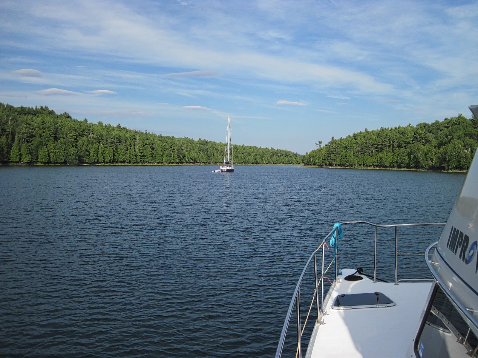
Thursday, August 20, 2015

BACK AT IT!

Got back to the boat yesterday. It was fun to be back home in California for a short while, and we took advantage of being there by seeing family and friends, catching up with doctors, dentists, etc. and, of course, Elaine getting to her High School reunion in Modesto.

We left for the San Francisco airport around 3:30 AM on Monday, boarded our plane around 5:15 then waited at the gate for over an hour while some minor maintenance on one engine was completed. While that was going on, there was a small earthquake (4.0), but it was big enough to trigger protocols which shut down the runways until they were inspected. We finally lifted off around 7:30, which made for a tight connection in Chicago, but we made it. However, as we taxied out for take-off, we were #14 in line. Due to bad weather, there was a minimum 2 minute separation, so it took well over half an hour to get airborne. Once we landed in Toronto, we were informed that the “alley” was too congested for us to move off of the taxiway, so we sat between runways for another 45 minutes. All in all, we spent 4.5 hours in the air, but over 8 hours on the planes for our flights. 

[While I’m in a whining mood, I must comment on Toronto Pearson Airport. Leaving Toronto, we arrived more than 2 hours prior to our flight time, and just barely made our flight after standing in incredible lines for check-in, US Customs clearance and security checks. Upon returning, we were in just as incredible lines for Canadian Customs & Border Patrol clearance. Although staff was tolerant and, for the most part, polite, it was very obvious that there are significant systems issues with their international passenger processes. Toronto is a very large, cosmopolitan city (largest in Canada) and should be prepared to handle the significant passenger through-put. They are not.]

We spent a couple of days with friends in Toronto (thanks, John & Kathe!) then caught a ride back to Midland to get “home” to the boat. All the travel caught up with us yesterday, both of us feeling pretty wiped out, so we sat by the lake, swam and pretty much did nothing for the day. This morning a forecasted storm system rolled through and when I got up and looked outside, it looked like an epic Cecile B. DeMille biblical storm scene with grey waves, whitecaps, torrential rain coming down sideways, lightening and thunder. I kind of expected Moses to come walking by, leading a horde of people ready to walk across the lakebed.

We’ll spend today as a “prep” day, getting everything ready on the boat and taking a run to the store for some provisioning so we can depart tomorrow. We are about an hour from the north/west terminus of the Trent-Severn Waterway and we’ll retrace our route back through the 45 locks to get to Lake Ontario. Depending on time and weather, we would like to take a short detour into the Thousand Islands area of the St. Lawrence River before getting to the south shore of the lake and down the Oswego Canal to Brewerton, NY.

We have made arrangements to have the boat stored on the hard for the winter inside a heated shed where she will be available for showing, since we have decided to list her for sale. In preparation for that, we will take off and store all of our personal items, have some routine mechanical work done and get her polished and waxed. I suspect that we will be ready to head back to the West Coast in late September.

In the meantime, our cruising adventure restarts tomorrow…


Saturday, August 1, 2015

MIDLAND - TAKING A BREAK

After our night at anchor in Chimney Bay, we took advantage of a lull in the wind and headed south to Midland. We have several days before our scheduled trip home, but decided we should not risk being caught in a bad weather situation to make a deadline, and, being early, we might want to spend an extra day or two in Toronto before we fly out. In Midland, we are being hosted by James & Jackie Powers who have kindly offered their dock as a temporary port for IMPROV.

Since we are in a cruising hiatus, the blog will take a break as well, to be started up on our return from California, currently scheduled for August 18. At that time, we’ll head back down the Trent-Severn Waterway and, if time allows, take a quick excursion down the St. Lawrence River to see the Thousand Islands area before crossing Lake Ontario and transiting the Oswego Canal to Brewerton where the boat will be for the winter.


See you then…

Thursday, July 30, 2015

BEAUSOLEIL NATIONAL PARK

Wednesday July 29

Beckwith Island, with all of its boats, was actually a nice island. The water was cool enough to be “refreshing,” but warm enough that Elaine actually went in swimming. It was also very clear. When we weighed anchor in the morning, I could clearly see it dug into the sand at over ten feet deep.

There were a couple of places east of Beausoleil Island which we had passed by on our way north a few weeks ago, so we thought we would explore a little bit. We cruised up the Musquash Channel, looking for a nice protected anchorage to wait out the 20+ knot winds forecast overnight. We went into Brown Bay, even tucked way past the big rock at the end into a cove only big enough for our boat. It was an idyllic spot, totally protected from any wind, but the water was brown - clear, but brown the color of tea. It was still early afternoon, so we got the dinghy down and went exploring around the top of Bone Island. Since we were out and around, we dinghied over to the Beausoleil National Park dock on the southern side of Bone Island and were surprised that it was almost empty. Elaine had read that there were things to do there, so we went back to the boat, weighed anchor and moved over to the park cove. It ended up that what she had read was for a different part of the park, on a different island. Oh well, we were there, so stayed anchored for the night. It was very warm, the wind that was supposed to come, didn’t, and we spent a fair amount of time in the water trying to cool off. As still as it was, we weren’t overly bothered by bugs…
IMPROV at anchor, Bone Island

Thursday July 30

The wind picked up a bit this morning, but there are so many islands, so close together, that it really isn’t bad getting around - you just have to be very aware of the forecasted wind direction when you go looking for a place to anchor for the night. With the winds at 10-15 knots, we went over to the Cedar Grove dock on Beausoleil Island. There was an empty spot on the dock, so we pulled in. This is the place Elaine had read about. There were trails, beaches, camping areas and a visitor center complete with nature talks.
Colorful frog on Beausoleil Island
We spent the day there, even getting the bikes down and biking a path which went down to the southern tip of the island. We were almost to the end when we were attacked by swarms of mosquitoes and decided to turn around. The dock was very exposed to the wind and the wakes of passing boats, so we left and went up to Chimney Bay, close to where we had anchored our first night a few weeks ago. The entertainment for the evening was watching boats coming in to the bay anchoring and those already there re-anchoring after dragging their anchors in the 20+ knot wind.


Elaine is convinced we are wind magnets. The forecast is for 20 knot winds tonight, dropping to 15 by midnight then back to 20 tomorrow night and through the weekend. May do a little more local exploring, then head back to Midland within the next few days…

Tuesday, July 28, 2015

CAPE CROKER/BECKWITH ISLAND

Monday, June 27

A pox on all credit card services! It was an extremely frustrating morning after filling our grocery cart, going through the check-out and having our credit card transaction not be authorized. Now, we are not exactly naive travelers or inexperienced when it comes to managing credit cards during international travel, so it was very upsetting to learn that our cards had been de-authorized. This was after letting the bank know when, where and for how long we would be traveling. In fact, I had phoned them within the past few weeks to update our travel location, but apparently, nobody pays any attention to that.

Elaine, getting us back to the boat on the dinghy
Allow me to back up just a couple of steps. Several weeks ago, we discovered that one of our credit cards (we carry two accounts) wouldn’t work. When I called the bank, they informed me that they had sent updated cards to our home address, and that all we had to do was use the new cards now that the previous cards had been cancelled. As idiotic a move as this was, since they knew we were on an extended travel schedule 3000 miles from home, we just decided we would not use that card anyway, and use the other account. Then the second bank did the exact same thing. When asked why they sent out new cards, even though the old ones had a year before expiration, they said it was a “service” to their customers to automatically extend the expiration date.

Bruce Peninsula
The bottom line was that the bank said they were bound by California State law to de-authorize the card and we were just SOL. So here we were, trying to pay for food and fuel in a small village in remote Ontario, Canada with a bad card. The bank’s solution was simple - “Just give us the address where you are staying, and we’ll mail you new cards within 5 business days.” Half of the islands where we anchor are uninhabited! No streets, no cottages, no postal service… And they’re going to catch up to us on the boat and hand us our new cards. Yeah, right. After over a half hour on the phone (being charged international roaming charges, even though it is supposed to be a toll-free number) I finally got through to a supervisor in the credit card fraud department. She managed to tweak something with our account and said it might work now, so try to buy something while she waited on the phone. I went to a restaurant at the end of the dock and tried to buy a cup of coffee with a credit card - their card machine was broken. I then went up to the street and started walking, trying to find some vendor who would take my card (all while the bank person was waiting on the line, and I was paying roaming charges). I found an LCBO (Liquor Control Board of Ontario - a wine shop), went in, grabbed the first bottle of wine I saw off the shelf and went to the register to use my card. It worked. The bank promised that it would continue working. Just in case, we walked to the local bank (on the highway, outside of town) and got some cash.

By this time, we figured it would have to be a short cruising day, so we took off toward Cape Croker and anchored in a nice, secluded harbor about 15 miles away.
Lighthouse on Cape Croker
River otter pups feasting on a fish carcass


Tuesday, July 28


We have two more days before the next front is forecast to pass through with 20+ knot winds. Our plane reservations for the quick visit home are 10 days away. We don’t want to be stuck too far away if the wind blows for too long, so we decided to start heading in the direction of Midland, where we will  moor the boat while we are gone.
Taking advantage of the autopilot to knit
Our initial thought was to hop down the Bruce Peninsula and spend the night in McGregor Bay, but we got there by about 11 AM, the weather was great with a light southwest wind and 1 foot waves, so we decided to make the 30 mile crossing to Beckwith Island, putting us on the east side of Georgian Bay. We are definitely back in the popular areas - there were about 35 boats anchored in the bay when we came around the point. There was plenty of room, though, so we anchored and appreciated the warm weather and the (little bit) warmer water in the southern bay…

Sunday, July 26, 2015

TOBERMORY

The wind died down a little overnight, but it was still there when we left Club Island about 7 AM. We continued on, picking up our bearing for Tobermory and passing between Flowerpot Island and Bear’s Rump Island.
One of the "flowerpot" formations on Flowerpot Island
Glad we waited until this morning - even with the slackened wind, it was not completely smooth cruising. We stuck our nose into the harbor at Flowerpot, knowing that there is a dock in there and it is a National Park where our docking permit is good for free mooring. The water is incredibly clear, and, although the depth sounder read 7 feet, it looked like we would hit rocks at any time. Elaine wasn’t comfortable going in, so we backed out and continued on to Big Tub Harbor, which is the only designated anchorage in Tobermory. Unfortunately, Big Tub Harbor is 40-50 feet deep and has a constant stream of tour and excursion boats going through it to look at the wrecks at the end of the harbor. We gave up and went over to the Municipal Docks and got a slip.

Tobermory is a cute little town with a resort feel to it. Lots of gift shops, clothing stores, restaurants, etc. We had a bit of a hassle getting electrical power at the docks, but while we were out exploring the shipwrecks in the harbor with the dinghy, they got everything squared away and we had power once we were back on board.
Shipwrecks in the harbor
It’s a very busy harbor, partly due to the season and partly due to the weekend, but there are private yachts (in the 60-70 foot range), tour boats, glass-bottom boats, ferries and even kayaks constantly streaming by our boat, which is docked at the outside end of the harbor. One of the draws here is the abundance of shipwrecks which can be seen in the clear water. Visibility is at least 50-60 feet underwater, although snorkeling is a bit of a challenge with the water being only about 60 degrees or so.

We took a walk around town, even checking out the 385 foot Chi-Cheemaun Ferry which goes over to Manitoulin Island. I talked with the tour boat operators who go out to Flowerpot Island, and they said the harbor entrance was 5 feet deep - plenty of room for my 2’4” draft. We may go out there tomorrow and check it out some more.

You can tell you’re in a decent little town when you run across a brew pub, especially one that brews a nice porter. It was pretty warm by the time we finished our walk around town so that porter tasted mighty fine.


We’ll need to do some provisioning tomorrow morning before we leave, but there’s a grocery store right at the harbor. Having minimal food on board is as good of excuse as any for dinner at a nice restaurant tonight…

Saturday, July 25, 2015

SNUG HARBOR/CLUB ISLAND

We left Spanish, heading for Gore Bay on Manitoulin Island under incredibly calm conditions, and were halfway there when the updated weather forecast was broadcast and changed our minds for us.
Calm morning, for a change
We’ve spend several days, now in the North Channel and, as pretty as it is, we decided to head back to Georgian Bay for a couple of reasons. One is that the forecasts have consistently predicted better weather in Georgian Bay and two, North Channel is quite remote and, in general, primitive. Elaine likes to see interesting towns, museums, shops, etc, and there’s more of that in Georgian Bay. So, instead of Gore Bay, we headed east through Little Current and anchored in Snug Harbor, positioning ourselves for the next weather window to head south, out of North Channel, across Georgian Bay to Tobermory.
Sung Harbor

Snug Harbor was a great place (although no cell/internet connection), being very protected and large enough for many boats. We anchored in about 30 feet of clear water. I scrubbed down the boat to get warmed up enough to dive in and clean the waterline and bottom. It took about a half hour to do the bottom, and I was pretty chilled by the time I was done.
Another great dining view in Snug Harbor


The forecast was for high winds overnight (naturally) and rain/thunderstorms in the morning, clearing by early afternoon. The winds never came, but the rain/thunderstorms appeared briefly and were gone by 10 AM. Updated weather called for 15 knot winds, decreasing by afternoon with wave height 2-3 feet, also decreasing by afternoon. We took off for Tobermory, about 45 miles away, and for the first ten miles it was tolerable, if not pleasant. Then we hit more open water and, by early afternoon, the winds picked up rather than died down. We were going into 3-4 foot waves and had to reduce our speed, which would have made it a very long slog into Tobermory.
Club Island anchorage
We had a couple of possible bail-out points, and about half way through the crossing ducked into an anchorage on Club Island - a deserted, low island with a large harbor which offered protection from the waves, although not much protection from the wind. At least the water surface is smooth, and we can wait out this front, which is supposed to pass through by midnight tonight, leaving calm conditions in the morning…

Friday, July 24, 2015

SPANISH RIVER

Thursday, July 23

The wind died down a bit overnight, so we weighed anchor to get out into the channel before the whitecaps started up again. The water at our anchorage had cleared up considerably overnight and I could see the anchor in about 20 feet of water as I was pulling it up. Too bad the water had not warmed up as well.

Our first idea was to go to Eagle Island which, on the chart, had a nice big bay on the northeast side, but scout out Gibson Bay on Fox Island on the way over. Gibson Bay actually looked pretty nice and protected, although it is deep water right up to shore, a couple of boats were already there, and it was only a few miles from our last anchorage. We kept on going to Eagle Island, where we were a bit disappointed in the exposure. The wind was already coming up and, clearly, hitting the bay fairly strong. We kept going. We had thought we might stop in at the town of Spanish in another day, so going in that direction we scouted out Shoepack Bay. It was very protected, although deep, small, and there were already boats anchored, swinging on one anchor. Because they were swinging, there was no room for anyone else to come in. We kept going. By this time, around noon, the wind had come up and there were 2-3 foot waves and whitecaps in the exposed channels. Spanish wasn’t that far away, so we headed there to spend the night in a marina.
Spanish Municipal Marina

It’s a nice marina, although not much of a town. There’s a sporting goods shop, a couple of minimal grocery stores, a liquor store and some restaurants about 1.5 miles away. The best thing about the marina is the community building right next door. It’s a modern, 2-story structure which houses classrooms, event spaces, a workout gym, laundromat and full washrooms with showers (which marina tenants can use).
Community center

After a walk into town, mainly just to stretch our legs, we were entertained by other boats trying to get in and out of their slips in the strong wind.
Ontario countryside around Spanish

It’s now Friday AM, and, looking at the weather forecast, we have a day before another strong front comes through with 20-30 knot winds. The extended forecast really doesn’t show much relief for another 3-4 days. We would like to head over to Tobermory on the Bruce Peninsula, but that entails some open water, so we may gradually position ourselves over the next couple of days, hopping from bay to bay, and take off for the crossing on the first good-weather day.
IMPROV docked at Spanish


Yesterday, we made plane reservations to head home for a week in August, so we will want to be back to Midland before we go,  to put the boat on a mooring while we are gone…